Research Across Observation Scales
My research connects sensing and data analysis across observation scales, from internal plant and soil structures to Earth observation, to address questions in digital and precision agriculture.
Open-source tools
X-ray microCT
Inside plants and soil
I combine X-ray imaging and software analysis to characterize internal plant tissues and soil structure.
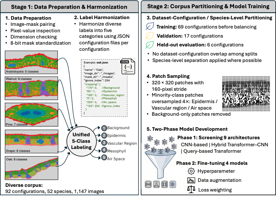
- Cross-species leaf tissue segmentationFrom CNNs to Vision Transformers: A Harmonized Framework for Cross-Species Plant Leaf MicroCT Tissue Segmentation Under review
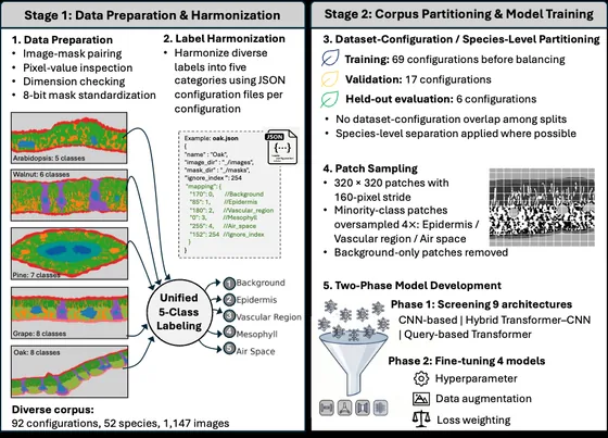 Training workflow
- Automated soil aggregate segmentation In development
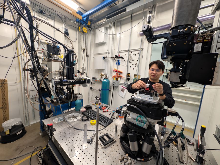
Preparing a soil aggregate sample for synchrotron microCT imaging at APS
Proximal Sensing
Around a plant
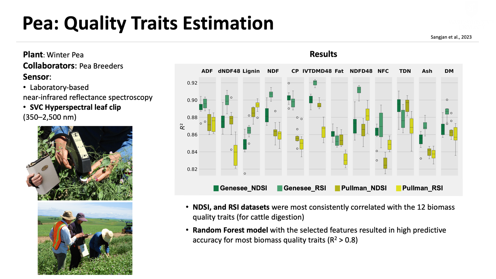
I use close-range imaging, spectroscopy, and chemical sensing to measure plant traits, assess forage quality, and detect signs of disease.
- Hyperspectral prediction of pea forage qualityEvaluation of forage quality in a pea breeding program using a hyperspectral sensing system
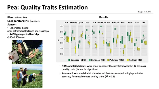 Research summary
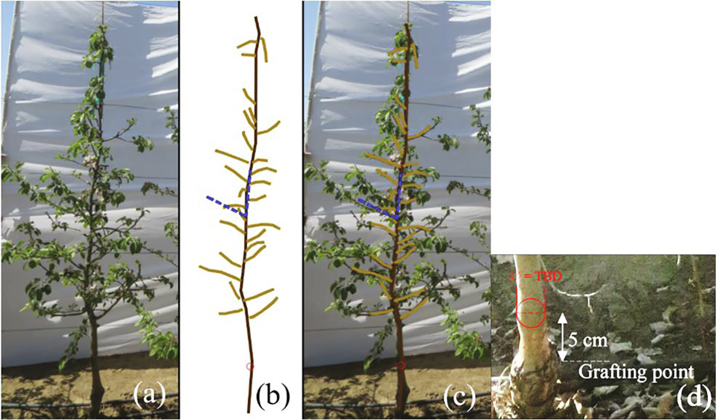
- Apple tree architecture and 3D point-cloud analysisProximal + UAVNon-invasive sensing techniques to phenotype multiple apple tree architectures
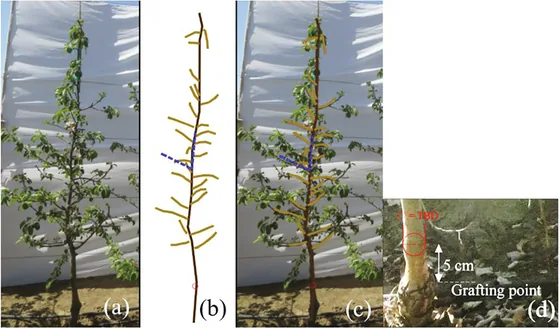 Trait extraction
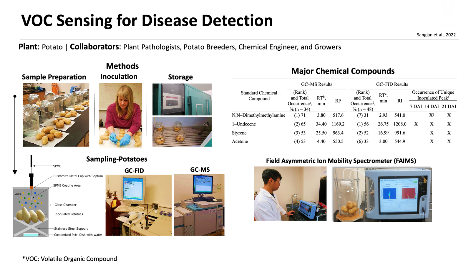
- Volatile biomarkers of disease in stored potatoesIdentification of volatile biomarkers for high-throughput sensing of soft rot and Pythium leak diseases in stored potatoes
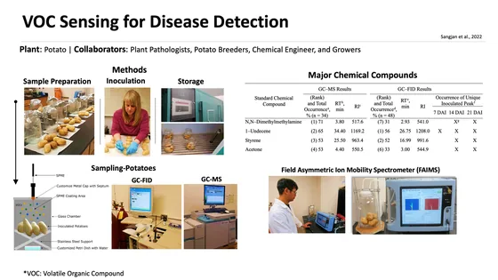 Research overview
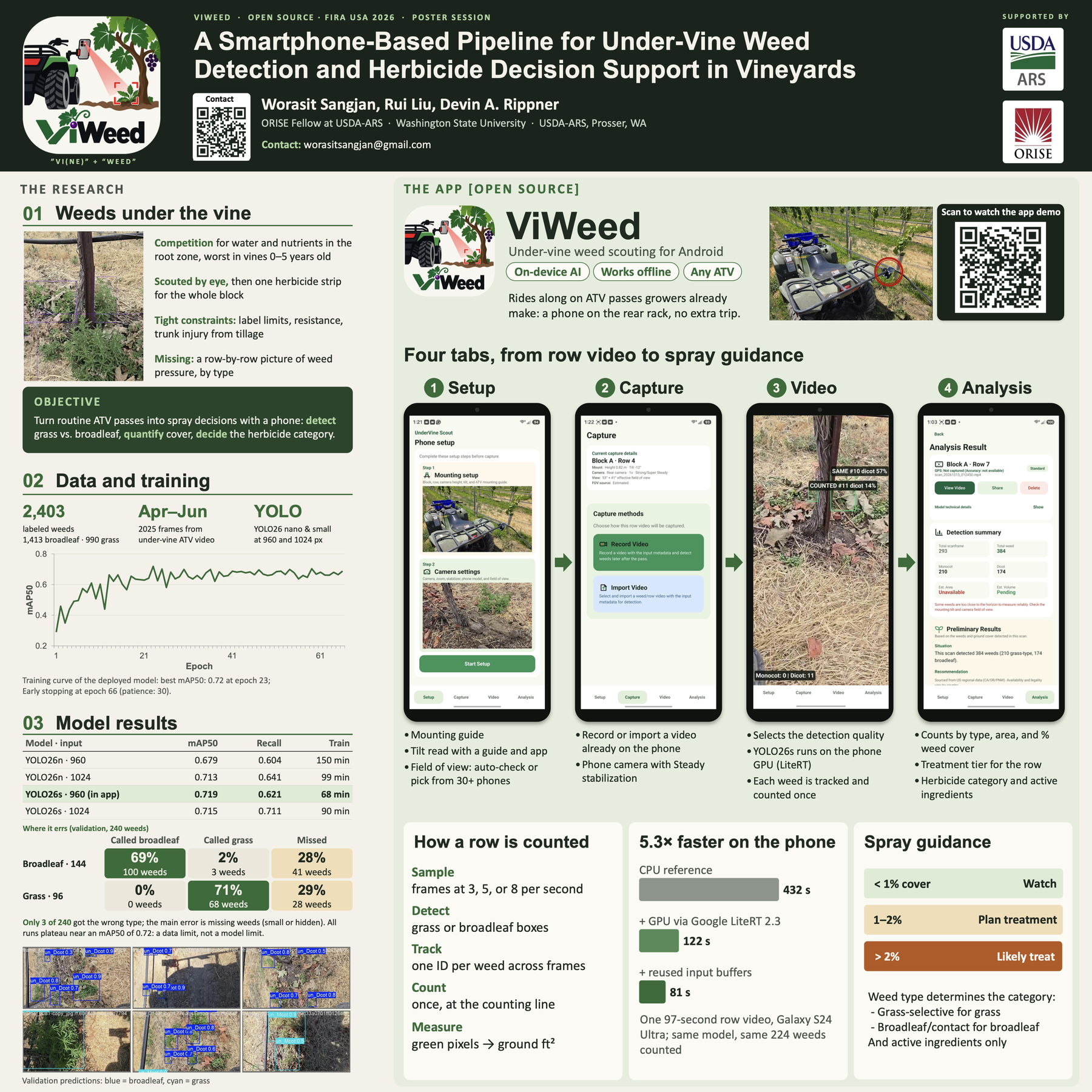
- Smartphone-based weed detection in vineyardsIn development
App demo 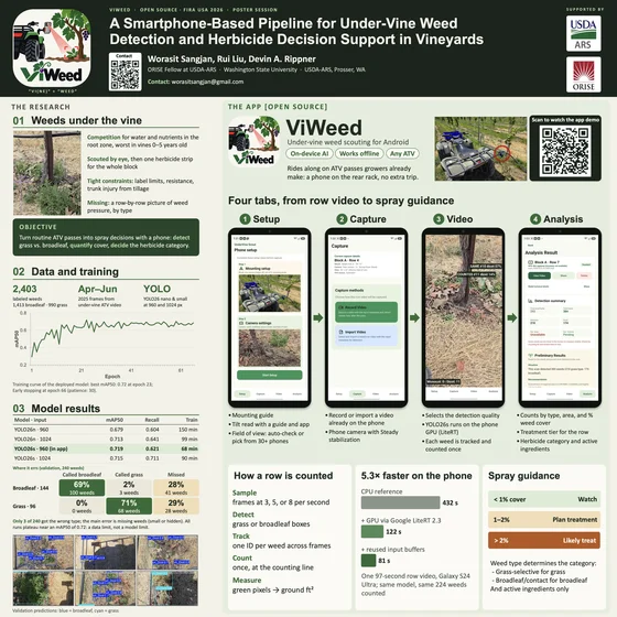 Poster presentation
Sensors and technology
- Hyperspectral spectroscopy, LiDAR, RGB-D cameras, and thermal cameras
- Volatile organic compound (VOC) sampling and analysis with GC-MS and GC-FID
Analysis methods
- Spectral feature selection and regression
- Machine learning and statistical analysis
- Image and point-cloud segmentation; voxel-based volume estimation
IoT Sensing
Across crop rows
I develop field sensing systems and analysis tools to monitor crop growth, predict yield, and study microclimates.
- Automated crop phenotyping and wheat yield predictionAGIcam: An open-source Internet of Things-based camera system for automated in-field phenotyping and yield prediction
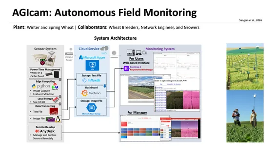 System architecture
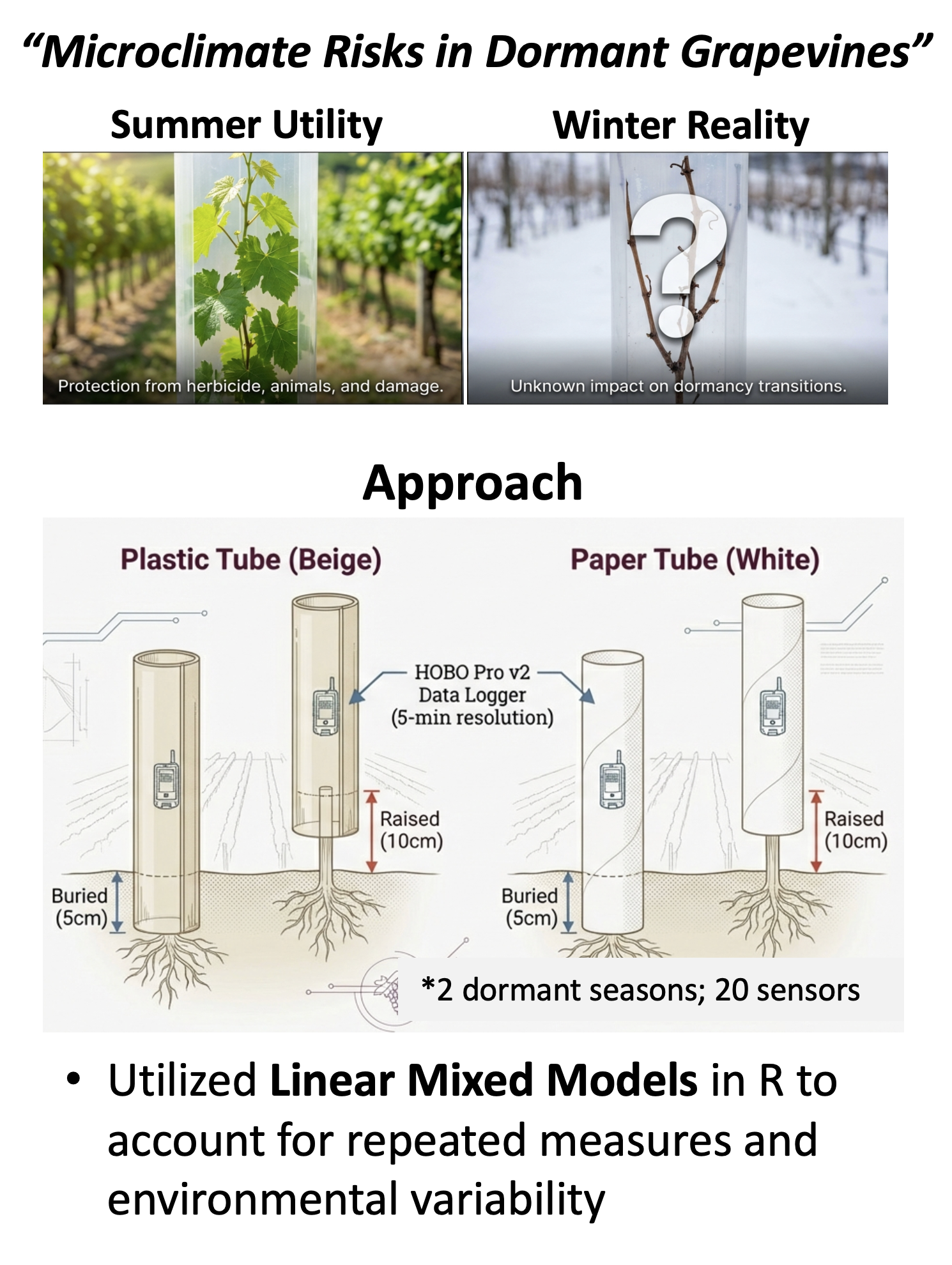
- Grapevine microclimates and cold-hardiness riskGrow tube material selection influences thermal microenvironments and cold hardiness risk in dormant grapevines
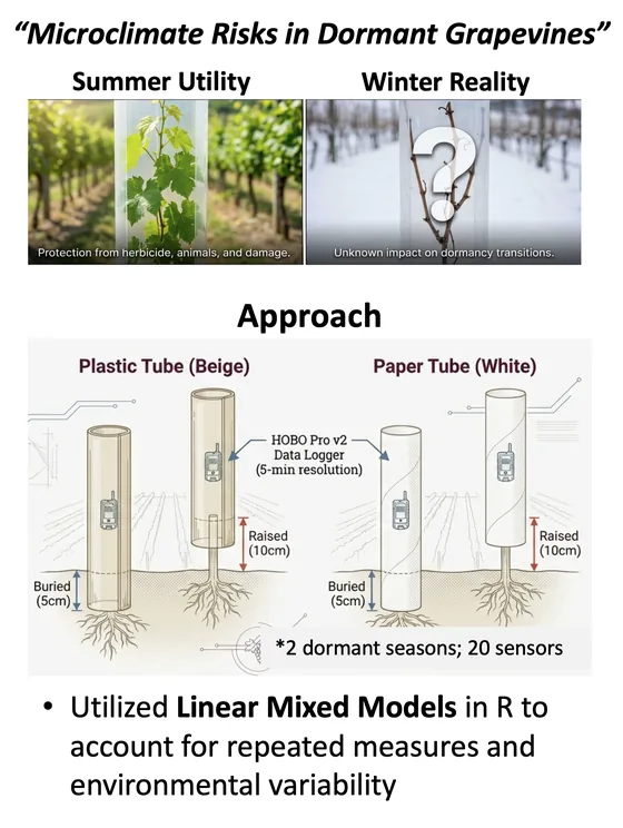 Study approach
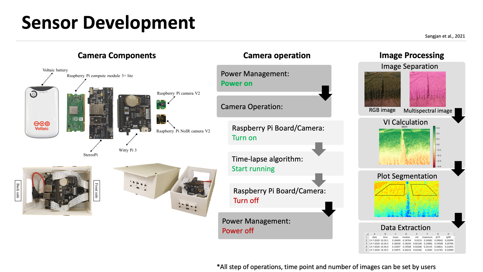
- Low-cost Raspberry Pi field sensor systemDevelopment of a Raspberry Pi-based sensor system for automated in-field monitoring to support crop breeding programs
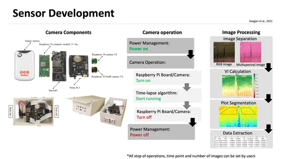 Sensor workflow
- Soil moisture at multiple depths and vine growth In development
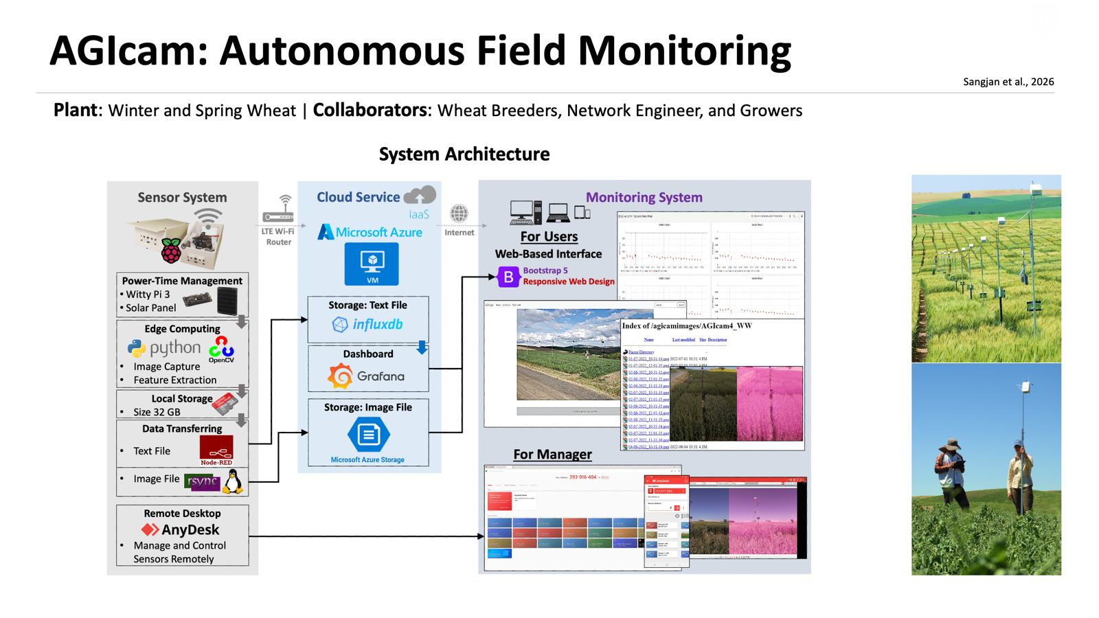
Sensors and technology
- Field cameras and sensors for temperature and soil moisture
- Raspberry Pi, Arduino, Node-RED, and Microsoft Azure
- Remote desktop tools: AnyDesk and RustDesk
Analysis methods
- Yield prediction from time-series data: random forest and long short-term memory (LSTM) models
- Microclimate and cold-hardiness modeling: linear mixed-effects models and physiological simulation
UAV Imaging
Above a field
I use UAV imagery to detect individual plants, reconstruct crop structure in 3D, and estimate biomass and yield.
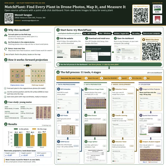
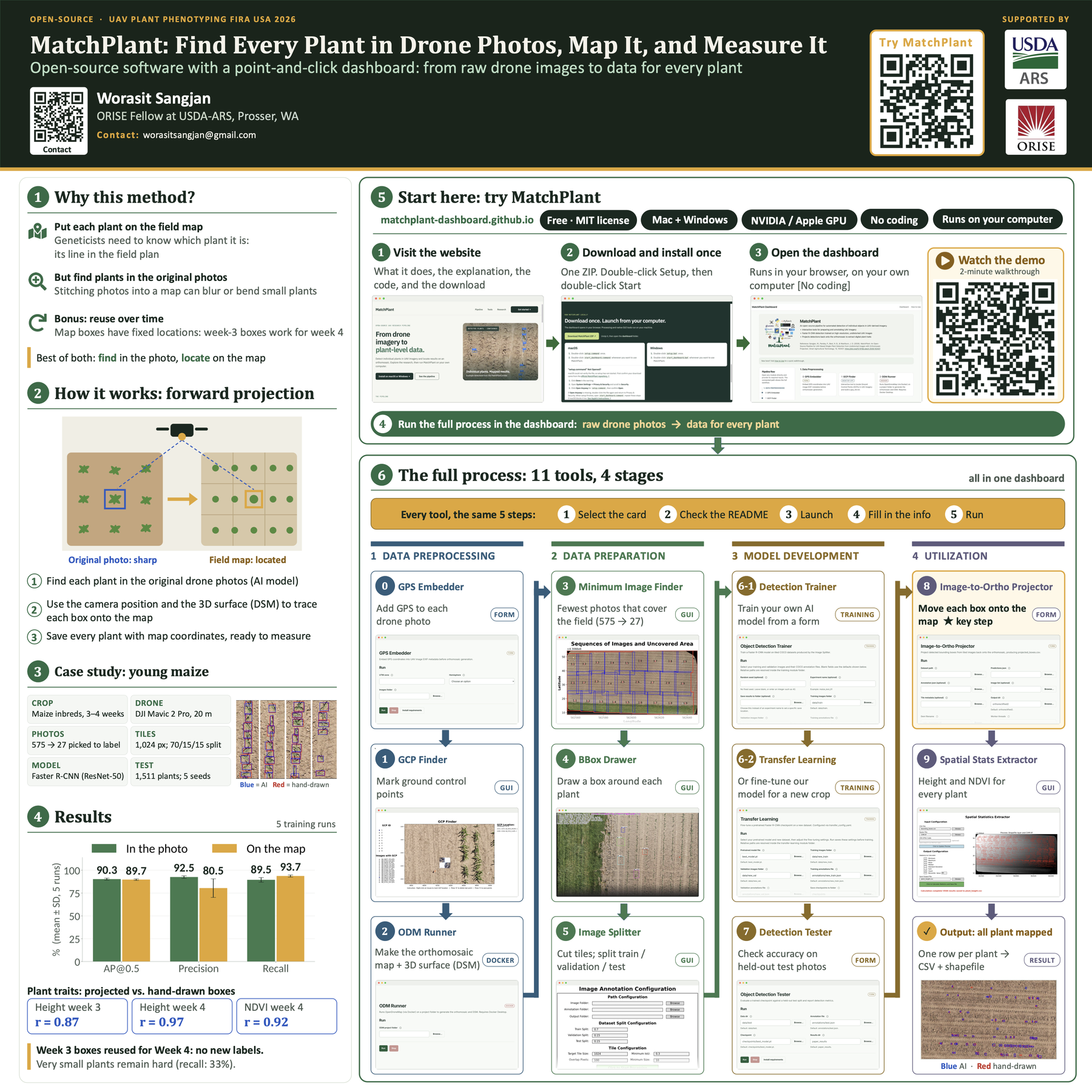
- Individual-plant detection and georeferenced mappingMatchPlant: An open-source pipeline for UAV-based single-plant detection from undistorted images with orthomosaic projection
 Poster presentation
- NDVI and wheat grain yield across environmentsVariability in crop responses as a function of environment affects the NDVI relationship with grain yield in wheat
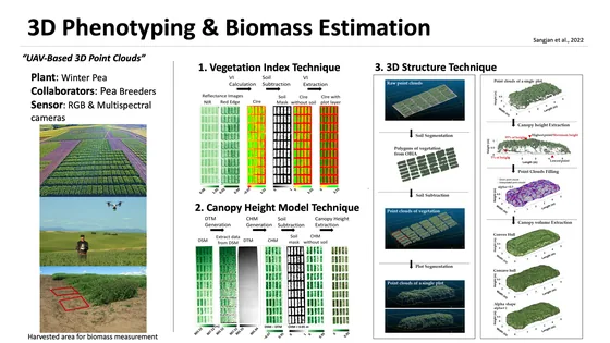
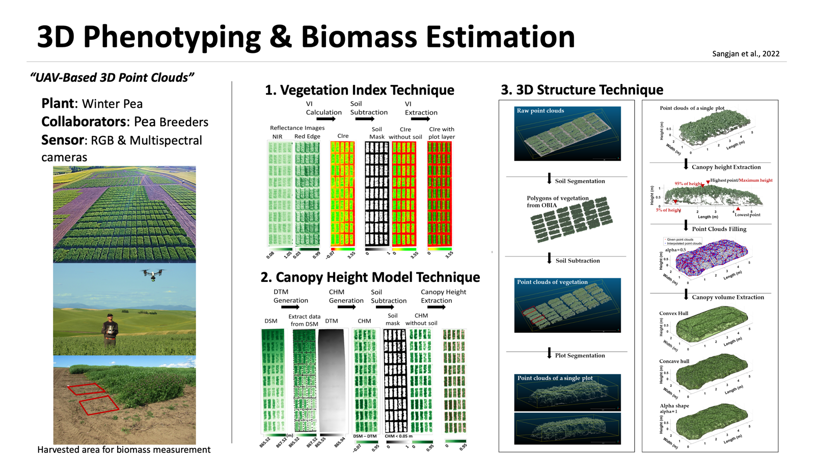
- UAV biomass estimation in forage cropsOptimization of UAV-based imaging and image processing orthomosaic and point cloud approaches for estimating biomass in a forage crop
 Research summary
- Solar zenith angle and vegetation indicesEffect of the solar zenith angles at different latitudes on estimated crop vegetation indices
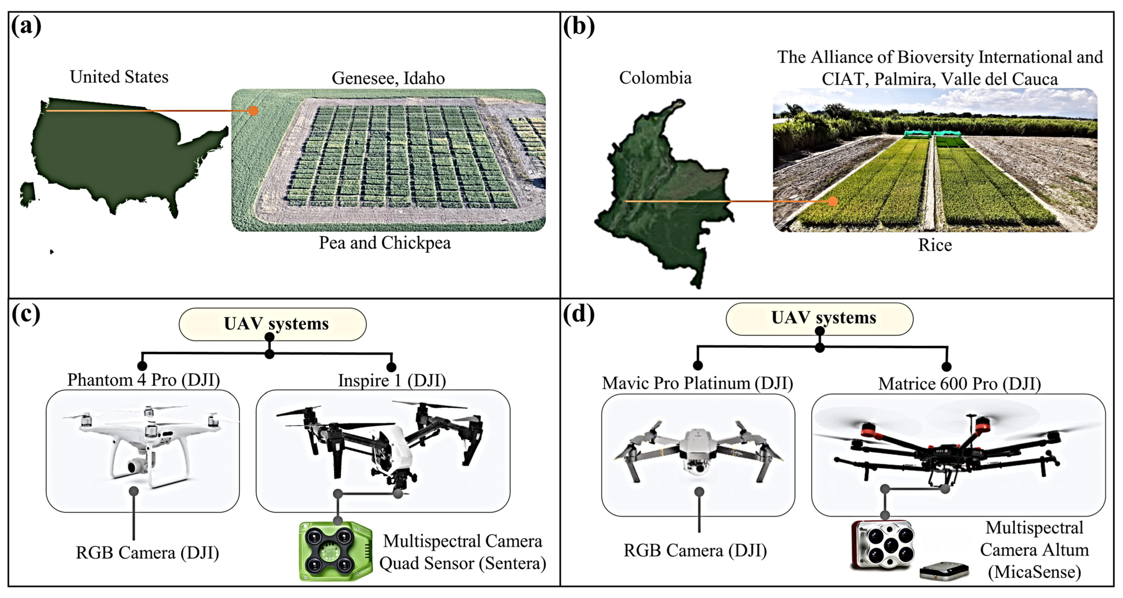
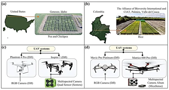 Study setup
Sensors and technology
- UAVs with RGB, multispectral, and thermal cameras, and LiDAR
- Photogrammetry and geospatial tools: Pix4D, OpenDroneMap, CloudCompare, and QGIS
- High-performance computing for MatchPlant: SCINet Scientific Computing
Analysis methods
- Object detection and geospatial analysis
- Deep learning and computer vision
- 3D point-cloud analysis and machine learning
Satellite Sensing
Earth observation
I analyze satellite observations to assess crop performance, monitor pasture productivity, and track drought over time.
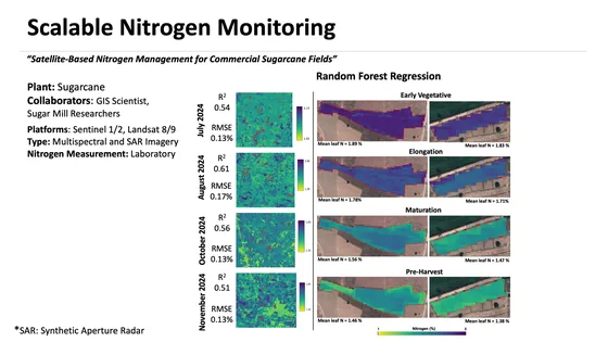
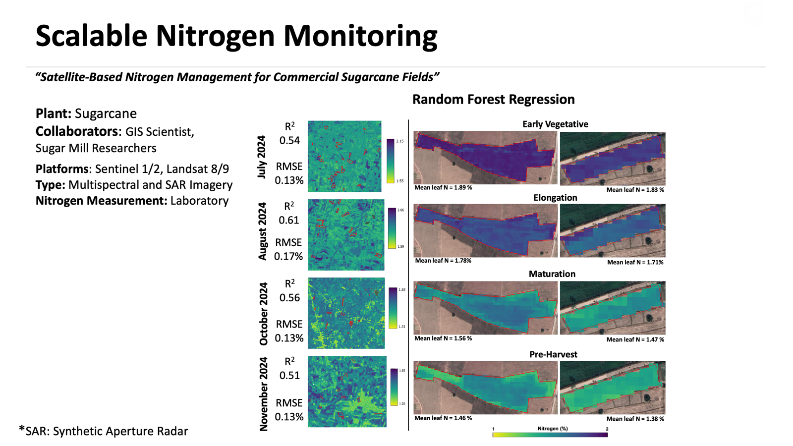
- Sugarcane nitrogen prediction from optical and SAR imagerySynergistic integration of SAR and optical remote sensing with machine learning for nitrogen prediction in sugarcane fields Under review
 Research summary
- Satellite-based drought monitoringSpatio-temporal drought monitoring in the Chi River basin from 2001-2020 using MODIS time series data and Google Earth Engine
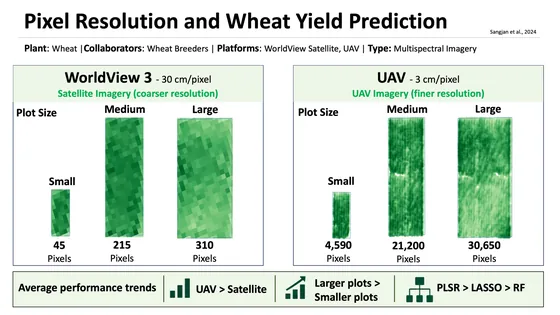
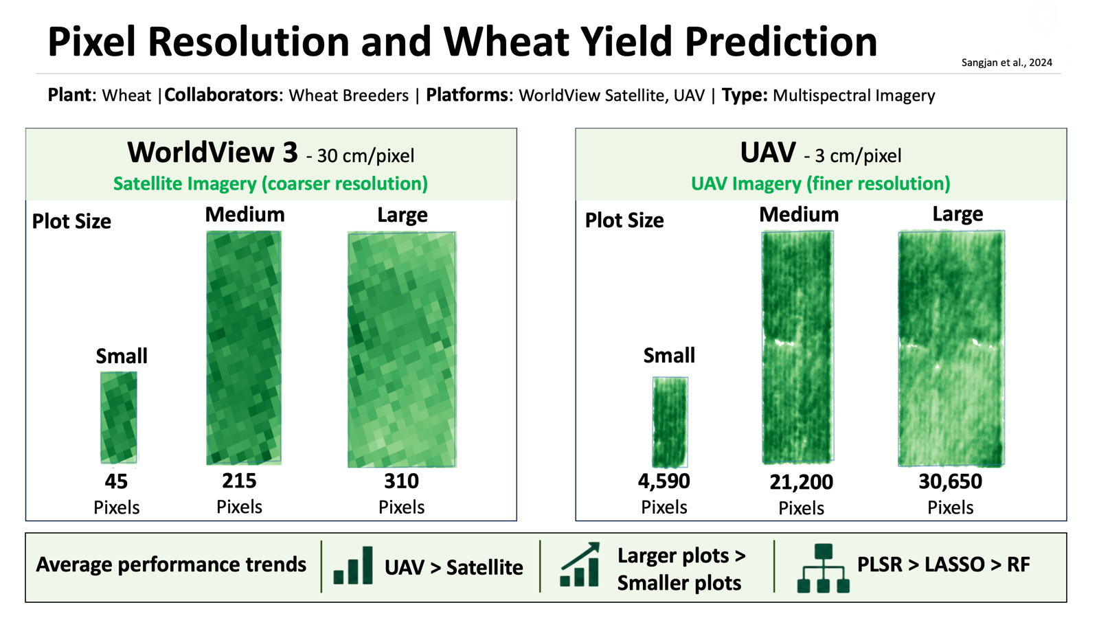
- Wheat yield prediction from satellite and UAV imageryUAV + satelliteEffect of high-resolution satellite and UAV imagery plot pixel resolution in wheat crop yield prediction
 Research summary
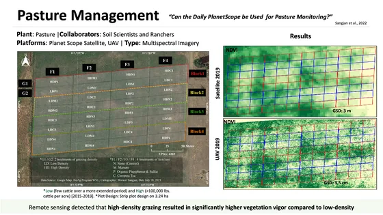
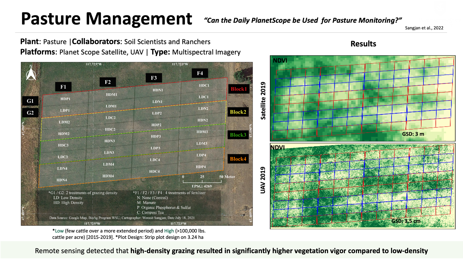
- Pasture productivity under mob grazingUAV + satellitePasture productivity assessment under mob grazing and fertility management using satellite and UAS imagery
 Research summary
Sensors and technology
- Optical satellite imagery and synthetic aperture radar (SAR) observations
- MODIS time series and Google Earth Engine
Analysis methods
- Spectral indices and data integration
- Spatial and temporal analysis; predictive modeling
Connecting measurement with understanding
Across these platforms, I use machine learning to predict plant traits and yield, and deep learning to detect objects and segment tissues. Time-series analysis and statistical and physiological models help interpret changes in crop growth and environmental conditions.
Publications across platforms
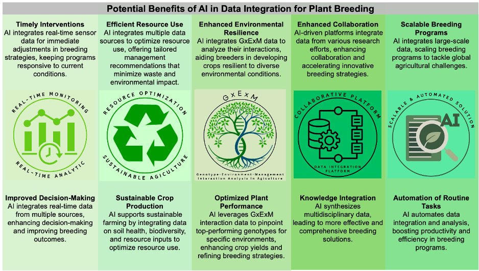
- AI-supported data integration for plant breedingImproving plant breeding through AI-supported data integration
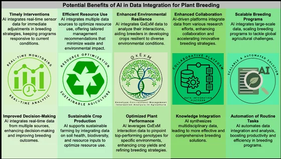 Research summary
- Affordable phenomics for plant breedingAffordable phenomics: Expanding access to enhancing genetic gain in plant breeding
- Remote sensing of tree architecturePhenotyping architecture traits of tree species using remote sensing techniques